Building a spatial database infrastructure
MIGE - MIgrations GErmany
- An interactive dashboard
Summary
The MIGE (MIgrations GErmany) project aims to create a spatial data infrastructure (SDI) to visualize migration data in Germany, leveraging an open GIS architecture. The project involved multiple phases, including data acquisition from reliable sources like Eurostat and Destatis, data preprocessing and integration, and implementation into a PostGIS database. The SDI system allows the data to be accessed as web services, enabling interactive and user-friendly presentations.
Key Points
- Data Sources & Processing: Population migration data was cleaned and spatially linked using NUTS codes, which were essential for dashboard visualizations.

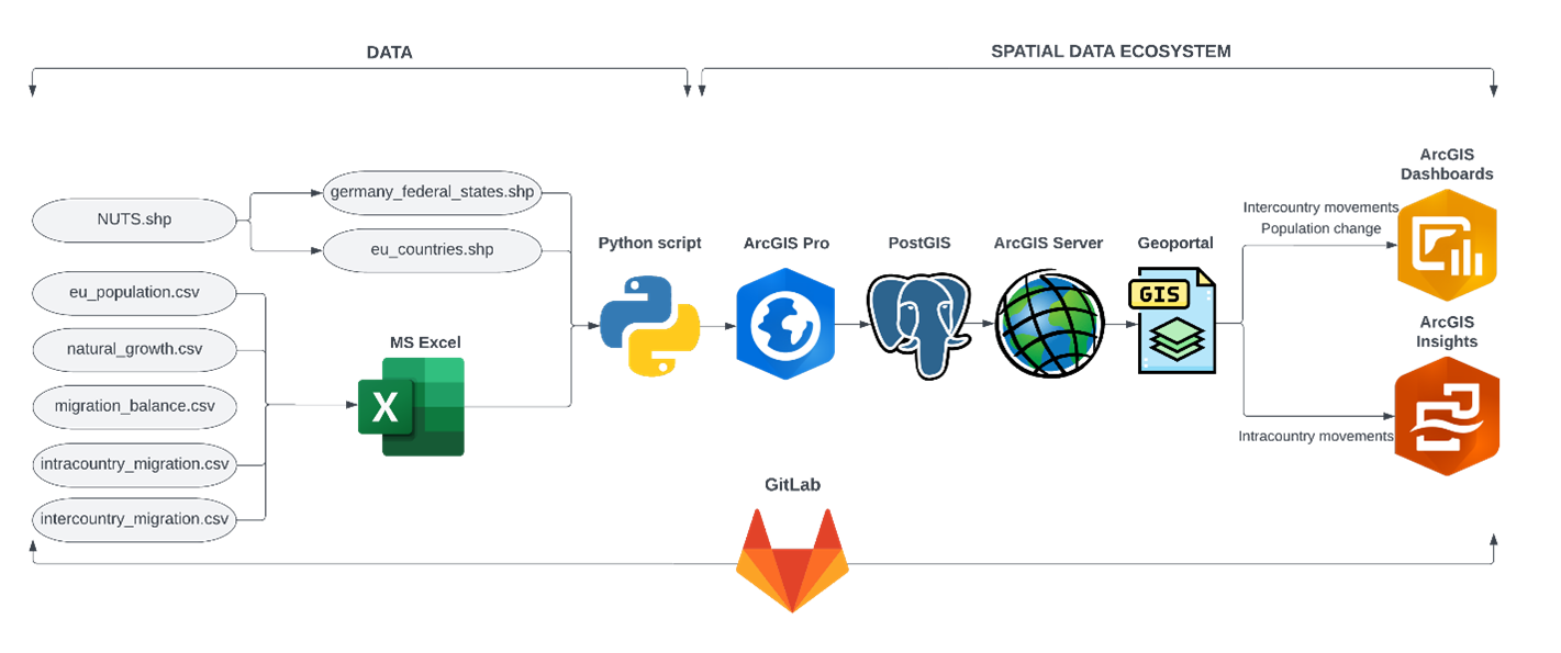
Generalized overview of data preparation
- SDI Architecture: A GIS-based infrastructure (ESRI) was established to facilitate the sharing and visualization of migration data.

General architecture overview

SDI architecture overview
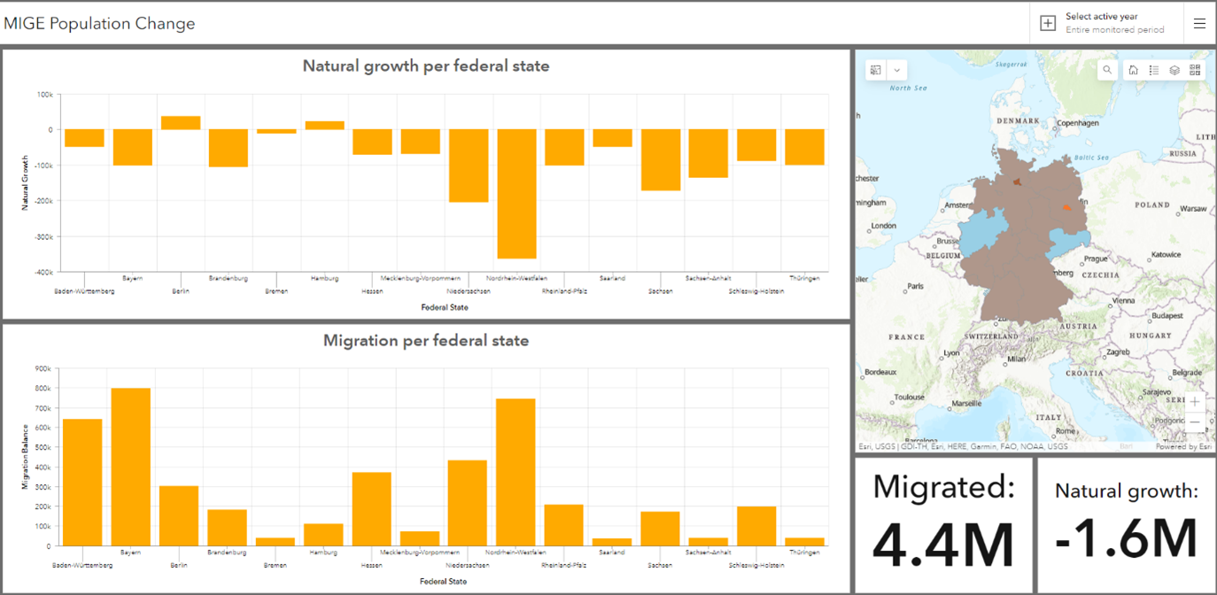
- Dashboards: Three dashboards illustrate intercountry migration, intracountry movements, and population changes across Germany, offering agencies intuitive, real-time insights into migration trends.

MIGE Population Change dashboard design
Full documentation: